Table Mountain
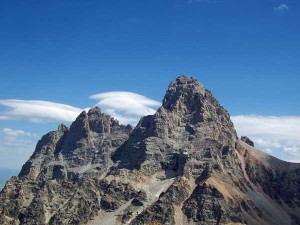
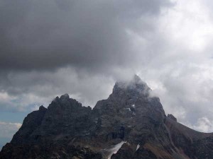
Posted by Jim Steele on August 11th, 2008 filed in Grand Teton National ParkThere are lots of hikes that offer stunning views of the Tetons – Sleeping Indian and Hermitage Point come to mind – but for an incredible, up-close view of the Grand and Middle Tetons, with no obstructions in the way, it’s tough to beat Table Mountain (Table Rock). Table Mountain lies just west of the Grand and is accessed via a trail that starts about 10 miles east of Driggs.

From Table Mountain, you’ll feel like you’re just a stone’s throw from the Grand, with nothing in between but the South Fork of Cascade Canyon. You’ll also be able to see Paintbrush Divide, Cascade Canyon, Hurricane Pass, and many of the other Teton peaks. There aren’t many better 360-degree views in the Tetons.
View Larger Map
Unfortunately, there is some pain and agony involved in getting to the summit. The hike starts near the valley floor in Teton Canyon at an elevation of 6,950 feet and climbs a grueling 4,150 feet to Table Mountain’s summit at 11,106 feet above sea level. And the worst of the agony is crammed into the final stretch of the trip, where you climb a steep trail to the summit without the aid of any switchbacks.

The trail starts at the Teton Canyon Campground. To get there, drive to Driggs and turn east at the intersection of Idaho Highway 33 and Little Avenue, which turns into Ski Hill Road. A stoplight marks the intersection and Key Bank sits on the northeast corner. Follow Ski Hill Road past various new houses and Alta, Wyoming, for 6.6 miles until you come to an intersection with a dirt road that leads to the Treasure Mountain Boy Scout Camp and Teton Canyon campground. Follow the road for 4.4 miles until you get to the campground. Park at the east end near a trailhead. Don’t get confused with the Alaska Basin Trail, which begins southeast of the campground.
The trail begins by switchbacking up the hill above the campground; you’ll quickly gain about 350 vertical feet. After the trail levels off, you’ll head northeast, following the North Fork of Teton Creek and quickly crossing into the Jedediah Smith Wilderness. The wilderness designation means that you won’t see any wheeled vehicles, including bicycles, on this trail. It also means that you’ll see some hikers with their dogs. You’ll spend most of the hike in the wilderness, although Table Mountain straddles the Grand Teton National Park boundary. The Tetons are just too spectacular to fit into one federal jurisdiction.
After a little more than a mile, you’ll come to the signed junction with the Fred’s Mountain Trail, which leads west. Early in the hike, you’ll pass in and out of spruce, lodgepole pine and aspen forests. You’ll also pass several meadows that practically beg you to pitch a tent. As you continue the reasonably gradual climb up the canyon, you’ll have four stream crossings. A sturdy footbridge is in place at one of the crossings, while less sturdy logs are in place at the other three. Most likely you’ll be able to cross on the logs, but you might decide to ford one of the crossings, particularly earlier in the season when hopping rocks isn’t a possibility.

You should also watch for a series of small waterfalls and cascades. Several lie within a dozen yards of the trail. If you hear a waterfall nearby, it’s probably worth a short detour.
About halfway through the hike, your route will start to curve to the south and you’ll begin to traverse a cirque that lies below Table Mountain. You’ll start to gain elevation in earnest as you climb out of the cirque. You’ll also catch your first view of the Tetons. A series of switchbacks will lead you to the rim above the cirque; it’s from here that you’ll enjoy your first panoramic view of the hike, with views of the Tetons, the cirque below, Teton County, Idaho, to your west, and Table Mountain.
Table Mountain appears desceptively close. You might think that you’re just a mile away, but you’ve actually got quite a bit of hiking left to do. You’re still roughly 1,200 vertical feet from the summit. You’ll make a horseshoe of sorts around the rim of the cirque, passing in and out of some light forests before crossing a field of rocks and then completing the steep climb directly up to Table Mountain without the benefit of switchbacks. The last few dozen yards are a steep – but non-technical – scramble.
Once you get there – no matter how badly your legs hurt – you’ll take in what is probably the best view of the Tetons. Little stands between you and the Grand Teton and Middle Teton but a fork of Cascade Canyon, and you’ll feel like you could throw a snowball at the summit. You look down on Hurricane Pass, can see out to the southern peaks of the Teton Range, can look through Cascade Canyon to see the Jackson Hole on the other side, will see a small lake just east of Cascade Canyon, and can see Paintbrush Divide. You also will see the checkered farmlands of Teton County, Idaho, and Teton Canyon. From Table Mountain, it’s tough to believe that you’re still more than 2,500 feet below the summit of the Grand Teton.

Bring your binoculars, camera and a lunch. If people are on the top of the Middle or Grand Tetons, you’ll be able to make them out. And if you’re a shutterbug, it’s going to be tough to beat this up-close view.
Be forewarned that solitude may be in short supply on this hike. Depending on the time of day, you could be sharing the summit with a dozen or more people – on our last trip to the top, a high school football team was having a team-building adventure. The proximity to Treasure Mountain Scout Camp means that there could be dozens of energetic scouts on the trail. This is one of the easiest Teton hikes for people in eastern Idaho to access. In addition, this trail could be inaccessible into July due to snow, so all of the traffic is squeezed into just a few months.
I’ve never had much luck seeing wildlife on this trail, but a bear sighting certainly isn’t beyond the realm of possibility. You have a great chance of seeing a fantastic wildflower show, with virtually every color of the rainbow represented. Snow can persist in the cirque below Table Mountain into August, offering the possibility of a wildflower show relatively late into the season. And if you time your hike just right, you could enjoy wildfloewrs for virtually the entire hike.
After you’ve enjoyed the view from the top, your best bet is to retrace your steps to get home. However, there is a second route that leads directly back to the campground. It’s shorter – and steeper – than the route that you followed to the top. It is marked by a cairn – but no sign – fairly close to the switchbacks that lead you back into Teton Canyon. The trail spurs off from the main trail at a 30-degree angle. If you want to try this alternate, and less popular, route home, watch for the cairn.
