Amphitheater and Delta Lakes: One of My Favorite Teton Hikes
Posted by Jim Steele on July 1st, 2008 filed in Grand Teton National Park(Note: Thanks to Joshua Mickelson for several of the pictures that are used in this article. Josh’s slideshow is here.)
When I’m writing about Grand Teton National Park, it’s easy to let the superlatives fly. A panoramic view of the valley? Check. A pristine lake? Sure. Surrounded by the Tetons? Of course. So when I say that the trip to Amphitheater Lake is one of the coolest hikes in the park, you can be forgiven if you’re skeptical.
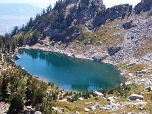
But this really is one of my favorite Teton hikes. Amphitheater Lake, which is tucked into a beautiful glacial cirque, is right in the heart of the Teton Range and on the way up, you’ll enjoy awesome views of Bradley and Taggart Lakes, along with much of Jackson Hole.
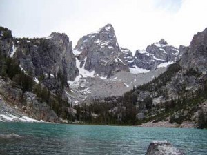
There’s also a possible side trip to Delta Lake, a lake that is right on par with Amphitheater for beauty but is seldom seen because there isn’t an official trail to it. Delta Lake is a cool glacial green color and Mount Owen seems to rise right from its western shore. But you don’t have to make the side trip to Delta Lake to make this adventure worthwhile.
Be warned that this is a tough hike. To get to Amphitheater, you climb to 9,698 feet, an elevation gain of about 3,000 feet over 4.8 miles from the valley floor. There is no respite from the elevation gain – you’re climbing for almost every step of this hike. I’m warning you in advance that if your in-laws were here three years ago and just loved “hiking” 0.5 miles to Hidden Falls after taking the shuttle boat and want to get “deep” into the Teton “backcountry” when they visit this summer, this is not an appropriate hike.
View Larger Map
To start out, drive to the Lupine Meadows trailhead. From Moose, drive north on the Inner Park Road towards Jenny Lake. About a mile south of the Jenny Lake area, you’ll see a sign for Lupine Meadows. Turn west here. Go straight through an unmarked junction and then cross a narrow bridge over Cottonwood Creek. Next, you’ll be able to turn right to get to the Jenny Lake boat ramp; instead proceed straight. Next, the road will turn to gravel and you’ll be able to turn left into an administrative area. Again, continue straight. The road will eventually turn to the south and lead you to the Lupine Meadows trailhead. There is a large parking area with an outhouse and no other facilities. On busy days, this parking lot fills up and you might have to find a spot to park along the road before the trailhead.
This is a busy trail. The first half provides access to Garnet Canyon as well as Amphitheater Lake so you might see some backpackers as well as people hoping to climb the Grand. Also, depending on snow conditions, you might run across some backcountry skiers or snowboarders.
This hike starts innocently enough. You hike south on a flat, once-paved trail through forest. Enjoy this – the elevation gain will start soon enough. The trail starts to curve to the southeast, skirting the edge of a lateral moraine. Before long, the trail turns and you start hiking up the moraine. You’ll continue wandering through the forest, crossing a bridge over waters that are flowing out of the Teton Glacier, before the trail eventually takes you straight up the ridge of the moraine. As you hike this section of trail, you’ll intermittently see the peaks of the Tetons to the west. You’ll seldom get a completely unobstructed view, but the sight is still impressive. You’ll also pass by several enormous glacial boulders. Several are the size of a cabin. This moraine rises above Glacier Gulch to the north and Burned Wagon Gulch to the south. This area is your best bet for seeing wildlife.
At the end of the moraine, you’ll come to a junction. At this point, you’ve gained about 650-700 feet since leaving the trailhead 1.7 miles ago. You’ve had a good workout, but you haven’t seen anything yet. You’ve still got 3.1 miles, with roughly 2,300 feet of elevation gain, to go. At this junction, you could take the Valley Trail and hike 1.2 miles to Bradley Lake and continue to Taggart Lake. Instead, continue up the mountain. You’ll be rewarded with cool views of Bradley and Taggart soon enough.
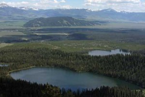
And now the work really begins. You’re going to switchback up the entire face of the mountain before you get to Amphitheater. As you rise, you’ll be treated to views of just about everything in the area. You’ll have bird’s-eye views of Bradley and Taggart Lakes for much of the hike and at certain points, you’ll be able to see parts of Jenny Lake and Jackson Lake. To the east, you’ll see the long, forested Timbered Island rising above the plain near the Inner Park Road south of Jenny Lake. You’ll also see Blacktail Butte and the Schwabacher’s Landing area. And of course you’ll see the Gros Ventre range and Jackson Peak. Depending on the season, the whole face of the mountain could be covered with wildflowers.
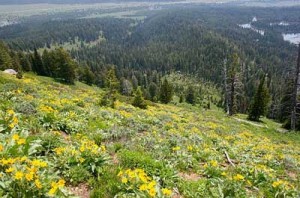
If you’re a shutterbug, you’ll enjoy this hike and the chance to take pictures of the valley. As you climb the mountain, you’ll alternate between being in the forest and being on the exposed face, with the higher areas more heavily forested. There are only a few places where you can take a picture with completely unobstructed views of Bradley and Taggart lakes, so if you want to capture this shot, don’t miss your chance assuming that there will be a better one a couple switchbacks ahead. There may not be.
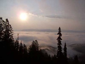
Partway up the face of the mountain, you’ll come to a junction with the Garnet Canyon trail. Climbers use this trail to access the Grand Teton or Middle Teton and plenty of people enjoy camping in Garnet Canyon. Even if you’re not climbing one of the peaks, Garnet Canyon up to Spaulding Falls is a great hike. Keep going straight at this junction to get to Amphitheater Lake; you’re 1.8 miles away.

At the next switchback, you’ll see a faint trail leading into Glacier Gulch. This unofficial route leads to Delta Lake. For some reason, there is not an officially maintained trail to Delta, which is a shame because it’s beautiful. The waters are a glacially inspired turquoise thanks to the Teton Glacier and Mount Owen rises dramatically above the west shore.
To get to Delta Lake requires some bush-whacking; the trail that you see at this switchback will eventually fade. However, it’s reasonably easy to get to it, as long as you don’t mind scrambling over some rock fields. You just walk up the gulch until you eventually get to the shores of the lake.
More challenging, however, is the hike back, just because it’s easy to miss the point where you need to exit the gulch to rejoin the Amphitheater Lake trail. If you do decide to take this side trip, which I recommend, glance behind you frequently so that you can plan your route out – there aren’t any markings. This would be a great place to use your GPS to note the coordinates at the junction.
From the switchback, you’re probably about a mile from Delta Lake, so if you decide to go to Amphitheater Lake and Delta Lake, your journey will be about 12 miles round trip. After the snow clears, it is hypothetically possible to climb the steep ridge between Delta and Amphitheater and avoid having to backtrack back to the Amphitheater Lake Trail and switchbacks, but I’ve never done it. If you want to try this, bring a good topo map because, again, there’s not an official trail.
After you’ve returned to the main trail from Delta Lake, you continue the switchbacks. When the trail finally starts to level out, you’re only a few minutes from Surprise Lake. Surprise is a quaint little lake set into a cirque that is 0.2 miles from Amphitheater Lake. Although it’s not very large, Surprise Lake is still pretty. A dramatic pinnacle rises above one shore and you’ll see that its outlet flows directly into the valley.


If you’re ambitious, you could try walking along its shores to the area above its outlet. From here, you can take in an absolutely spectacular view of the valley, with a corner of Taggart Lake visible, along with Blacktail Butte. Again, this is not an official trail and your results may vary.

To continue on to Amphitheater Lake, continue 0.2 miles up the main trail, gaining a little elevation along the way. Amphitheater, which is also set into a cirque, is gorgeous. Disappointment Peak, the Grand Teton and Teewinot are all visible around the lake, the water seems pure enough to bottle up and sell for $1.50 a pint, and you get the sense that you’ve truly arrived in the Tetons, since all sight of the valley below has been lost. While you’re here, get out your binoculars and watch for mountain climbers in the surrounding peaks.
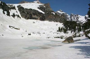
From here, you have at least two more opportunities to augment your adventure. First, you can climb the hills around Amphitheater. If you follow the trail around the lake, you’ll be able to glimpse down Glacier Gulch. If you then continue to rise above the shore, you’ll see a truly awesome scene with Jackson Hole in the background of Amphitheater, with the lake perched dramatically above the valley floor. This view is absolutely spectacular and you’ll feel like you’re on top of the world – despite the Tetons looming behind you. Again, this requires you to go off trail and the slopes are steep, so your mileage may vary.
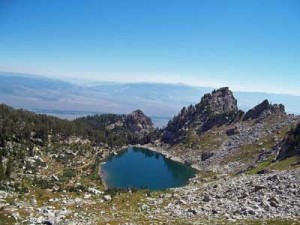
And you can catch a cool view of Delta Lake if, after you leave Amphitheater Lake, you blaze your own trail north instead of following the main trail back to Surprise Lake. Bring a topo map so that you know what you’re doing, but you’re only a few minutes from a cool view from several hundred feet above the turquoise waters of Delta Lake and another dramatic view of the surrounding mountains and Glacier Gulch.
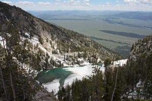
There is a backcountry campsite around Amphitheater and Surprise lakes. Unless you’re planning on technical climbing, there is no real way to continue your trip beyond Amphitheater Lake, although you could explore Garnet Canyon while you’re in the neighborhood. To get home, simply retrace your steps.
Trail conditions: I’ve been to Amphitheater three times, once in early September, in the middle of June last year, and on June 28 this year. Last year, the trail was generally clear of snow in the middle of June, although there were plenty of patches. This year, however, much of the final mile was still covered with almost continuous snow, both lakes were mostly frozen over, and the area around Amphitheater Lake had several feet of snow. There will be plenty of snow well into July.
