Ski Lake: A Perfect After-Work Hike
Posted by Jim Steele on June 27th, 2008 filed in Around TownSki Lake is one of the great after-work hikes that offers a little bit of everything: it’s close to town, it’s short enough that you can still get there in a couple of hours, you’ll enjoy cool views of a mountain lake and Jackson Hole, and there’s enough elevation gain to give you a good workout. Round-trip, this hike is about five miles, with 1,000 feet of elevation gain. Along the way, you might see a few trail runners.

The trailhead is easy to get to. From Jackson, drive west on Wyoming 22 past Wilson and start up the Teton Pass. About halfway up, you’ll go around a big bend that is almost a U-turn; just past this bend, you’ll see an old sign for Phillips Canyon on the north side of the road. The trailhead is here. You can either parallel park on the Phillips Canyon dirt road or park in the large unpaved lot just down the highway. The Phillips Canyon road can be easy to miss. Watch for a set of power lines; that will let you know that you’re close by.
View Larger Map
There is a sign with a map of the Teton Pass area trails at the trailhead. According to the sign, you’re going to gain 1,000 feet of elevation on your way to the lake and the trip is six miles round trip. I would guess that six miles is on the high side for this hike, but it’s in that range.
Initially, you’ll walk along a gravel road through the forest; you might see a few trucks or mountain bikers go by. After a few minutes, you’ll come to two quick junctions. You want to make a left turn at the first one, marked with a sign showing “Sno-Tel to Phillips Canyon” and “Phillips Canyon to Ski Lake Horse and Hike Trail.” Next, you’ll come to a sign that shows Ski Lake and Phillips Pass. Again, you want to turn left here. The gravel road will continue below you.
You’ll continue to wander through alternating forest and sagebrush, rising above the gravel road below and walking across the face of a hill. Depending on the season, wildflowers might be out. As you climb, you’ll start to enjoy views of the valley to the east. Eventually the trail will turn west into a dense forest and turn away from the gravel road; take a minute to enjoy the scene from this viewpoint.
After you pass through the short stretch of forest, the trail opens into a serene meadow. It seems like a great place to see wildlife, although I’ve never had much luck here. Depending on how busy the trail is, this can be a very peaceful area. During the snowmelt season, you might also find the area to be almost completely flooded.
You’ll cross over a small bridge and then pass through the meadow, soon coming to a junction. The sign says that you are one mile from Ski Lake if you continue straight or three miles from Phillips Pass if you turn right (north). The Phillips Pass trail will eventually connect with the Teton Crest Trail and lead you right into the heart of the Tetons, although it would be a long trip from here.
Past this junction, you continue to climb up to Ski Lake, passing through a variety of vegetation, following a creek part of the way, and eventually hiking up a fairly steep slope that will offer you more cool views of the valley behind you and the nearby mountains. The lake isn’t far beyond this slope.

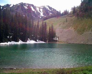
Ski Lake is tucked into a cirque, surrounded by steep slopes and forests. It’s a great place to pack a picnic and eat along the shores. If you come back through the summer, you’ll see the water level fluctuate. Ski Lake doesn’t seem to have a source of water beyond spring snowmelt.
A trail continues along the north shore of the lake. If you continue, you’ll get to see the lake from above. Eventually this trail will lead you to the top of Teton Pass.
To get home, retrace your steps.
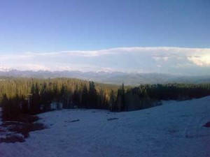
Trail conditions: On June 18, this trail was almost completely clear of snow up to the point where you turn into the dense forest before the meadow. Past this point, it was almost completely snowbound, and Ski Lake was still partially frozen. The trail was impossible to follow and the trip would have been difficult if I wasn’t familiar with the area. It won’t take long for the snow to melt, but you might want to give it another week or two.
Link
