Josie’s Ridge: Another Great After-Work Hike
Posted by Jim Steele on May 13th, 2008 filed in Around TownOne of my favorite after-work hikes is the Josie’s Ridge trail. The trailhead is in Jackson, the views of town from the top are tough to beat, and there is enough elevation gain to give you a great workout. There’s more elevation gain than High School Butte and it’s every bit as steep.

There are various trails that link Snow King, the bike path, Josie’s Ridge, the Sink or Swim Trail, and other trails on the ridge on the south end of Jackson proper. I will describe one way to get to the top – but there are plenty of others that might work better for you. I don’t know what the exact distance to the top is, but plan on at least an hour and a half roundtrip.
View Larger Map
This trail is never as busy as I expect it would be – it seems to be somewhat “undiscovered.” You’ll run into people on your way up, but you won’t see nearly as many as you will walking up the main Snow King trail. Most people will be hiking, but you might see a genetic anomaly that is able to jog to the top or a die-hard mountain biker.
The Josie’s Ridge trail starts near the Flat Creek bridge on the bike path. To get to the trailhead, you’ll have to walk along the bike path. Park along Elk Run behind the new post office. The bike path starts here. Walk south along it for a half mile or so to the Flat Creek bridge. Here, you’ll encounter a junction where the bike path continues to your right, the KC Trail begins to your left, and another trail begins climbing above the bike path. This is your route – and the point where you’ll start to gain elevation.
Shortly after you leave the bike path, you’ll come to a triangle junction. Keep going straight. You’ll gain elevation fairly gradually at first, passing two trails to the right that lead to a residential area. After these two junctions, the real work begins – the trail becomes more steep as you pass under a power line. Shortly after you pass under the power line, the trail temporarily levels out and you’ll parallel the power line on a clear area of the slope with views of Jackson.
Next, you’ll come to a junction where you can continue going east on a trail marked “Josie’s Ridge Easy Way” or continue your workout on the trail marked “Josie’s Ridge Steepest Way.” This article will describe the tougher option. Take a right at this junction and you will start switchbacking up the hill. Before long, you’ll be able to see to the top – and you’ll realize why this trail is such a great workout. You’ll only run into one more major junction before you get to the top. It’s not marked, but this is where the “Josie’s Ridge Easy Way” and “Josie’s Ridge Steepest Way” trails reunite. At this junction, one trail heads down and the other continues the ascent. If you want to make it to the top, follow your best judgment here.
Past the unmarked junction, you’ll spend some time in sagebrush clearings and some time in forests. The clearings offer more cool views of town. You switchback up the mountain the whole way, and the grade is unforgiving until you reach the top.
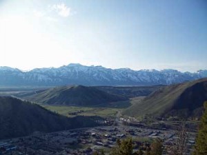
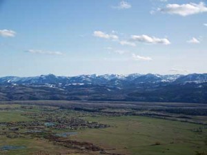
From the top, you’ll be able to see the Tetons, into the Elk Refuge, parts of the area south of town, and over High School Butte. The views aren’t perfectly panoramic – the forest gets in the way – but you’ll still have the feeling that you’re on top of the world. You’ve gained about 1,000 feet.
From here, you have a few options. The trail splits into two. One route continues east to the summit of Snow King. Another trail heads south along a ridge that ends right above the Smith’s Food and Drug store. Or you can turn around and retrace your steps.
The route to the Snow King summit will be another article. From the summit, you can ride the chairlift down to the base during the hours it is in operation, then walk along the city streets back to the post office to complete your loop. You’ll gain about 500 more feet of elevation if you continue to Snow King.
The route along the ridge to the south gains a little more elevation. Round trip, this side trip adds about 30 minutes to your hike – but the views from the end are worth it. From the south end of the ridge, you’ll have unobstructed views of the Rafter J area of Jackson. You’ll also be able to see back to the radio towers at the top of Snow King, Leek’s Canyon, and back to Teton Pass. This trail is surprisingly lightly used.

Trail conditions: I hiked up Josie’s Ridge on May 10. There were a few snowy patches and muddy areas, but getting to the top in standard hiking boots was no problem. This trail will probably remain accessible into November.
Jackson Hole Community Pathways 5-Year Town Pathways Vision map (pdf)
