Mt. Holmes
Posted by Jim Steele on August 10th, 2009 filed in Yellowstone National ParkThere are three fire lookouts in Yellowstone National Park, on Mount Washburn in the northeast corner of the park, Mt. Sheridan in the southern section, and Mt. Holmes in the northwest region. The same qualities that make these mountains good fire lookouts also make them spectacular day hikes, with 360-degree views that are tough to beat. I hiked up Mt. Holmes a few weeks ago, thoroughly enjoying the trip and wishing that I could spend the whole summer in the small fire lookout at the summit.
What incredible sunrises and sunsets you’d see from your vantage point on top of the world.

Mt. Holmes can be done as a long day hike or as an overnight adventure. The elevation gain is significant — about 3,000 feet over 10 miles — so be prepared for a grueling day. The majority of the elevation gain is packed into the final third of the hike.Â
View Larger Map
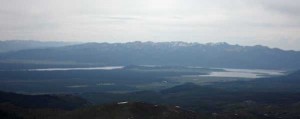
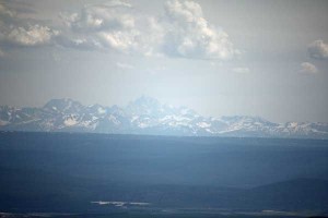
But when you get to the summit, you’ll take in sweeping views of Electric Peak to the north, Hebgen Lake to the west, the Tetons on the far southern horizon on a clear day, and Mt. Washburn to the east. I hope you’ll agree that the trip was worth every step.

The trailhead is between Norris Junction and Mammoth Hot Springs on Yellowstone’s Grand Loop Road, roughly nine miles north of Norris Junction and a mile north of the Obsidian Cliff. There is a small parking lot, but no other trailhead facilities. The trail quickly crosses a meadow then turns to the north after reaching the base of a hill. You’ll follow a set of power lines for less than a mile until you ford Winter Creek. The ford is fairly modest, even in early July, and you may be able to cross on fallen logs.
From here, you begin to head west, following Winter Creek for a few miles. The majority of the forests you‘ll pass through have burned, so expect plenty of fallen trees and little cover. Most of this hike is, candidly, forgettable, although the views of the nearby mountains begin to open up as you get closer to Mt. Holmes and the open terrain makes wildflower displays a possibility. After 2.5 miles, you come to a junction with a trail to Grizzly Lake. Stay right, continuing to follow the creek.
After another 3.1 miles, you’ll come to a meadow and a couple of backcountry campsites. They are the only campsites along this trail and look like they would be a thoroughly pleasant place to camp, regardless of the fires that charred many of the nearby forests. The trail passes by a patrol cabin and the intersection with the Trilobite Lake Trail. This is the last junction you will pass; you are 5.2 miles from the summit.
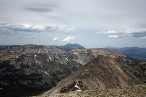
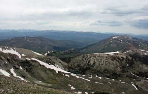
Now you will begin to gain elevation in earnest. The trail climbs above the meadow, passes south of Mount Holmes, and climbs to a saddle southeast of the summit. From here, you have about one mile and about 1,000 feet of elevation gain between you and the top. The trail crosses some scree fields, switchbacks a couple of times, and finally comes to the top, where you’ll see the fire lookout, a very primitive outhouse, and a United States Geologic Survey marker.

Bring your binoculars and leave yourself plenty of time, because you’re going to be treated to an incredible view. You’ll be able to trace much of your route from the top. Far to the south, you can see the Tetons on a clear day. Closer, Norris Geyser Basin is easy to pick out as a large white spot among the forests. To the west, you’ll see Hebgen Lake. To the north, Electric Peak, named for its propensity to attract lightning, dominates the skyline. East of Electric Peak, Bunsen Peak looks like a molehill, which puts everything in perspective because Bunsen Peak rises about 1,500 feet from the surrounding terrain. And to the east, you see Mt. Washburn, including the outline of its own fire lookout tower, and the Absaroka Range behind it.

In years past, the National Park Service has staffed the fire lookout, but for the first time in recent memory, no one is manning the tower this summer. Satellites have largely made the job unnecessary. There was no one at the Mt. Sheridan tower last summer, although the Mt. Washburn tower is still being staffed.
To get back, retrace your steps. Keep an eye on the weather, as afternoon thunderstorms can develop and the summit is exposed.
I did this hike in mid-July and only had to cross a few minor patches of snow. I wouldn’t have wanted to do this hike much earlier than I did, as a little bit of snow over the past couple of miles would have made the hike unsafe. Also, there was a prosperous local mosquito population along Winter Creek, so be sure to bring bug spray.
Note that if you are planning to try this hike in Summer 2009, delays are possible along the road between Norris Junction and Madison Junction, which is under construction. That road will close for the season in mid-August, so you may have to detour through Canyon Village.


July 23rd, 2013 at 10:45 am
[…] have two choices: You can start retracing your steps – go back to the Shoshone Geyser Basin, Mt. Holmes and the Bechler Canyon. Or you can start visiting some of the second-tier locations, like the […]