Chicken Springs Canyon and the Upper Palisades Lake Overlook
Posted by Jim Steele on June 2nd, 2008 filed in Idaho“I went hiking and things didn’t go according to plan” is sometimes a euphemism for “I went hiking and something really bad happened.” My plan Saturday was to hike up to the Upper Palisades Lake in Idaho. When I was stopped by a bridge that was out, I went exploring – and instead discovered the Upper Palisades Lake Overlook.
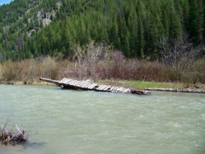
I have already written about my trip to the Lower Palisades Lake earlier this spring. I wanted to make it back to the Upper Palisades Lake and into Waterfall Canyon this year. Before I left town, I knew that the bridge to the Upper Palisades Lake had been washed out and that a replacement bridge wouldn’t be in place until the middle of June.
Not to be deterred, I figured I would just ford Palisades Creek to get to the lake. When I got to the crossing, I took a few trial steps into the creek, hoping for the best. After about five steps, the water was up past my knees; with about 30 steps left to go, I knew this adventure wasn’t going to have a happy ending. So, with my spirits broken, I turned around.

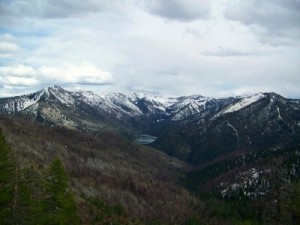
A few minutes down the trail, I decided to explore Chicken Springs Canyon. The bridge washout was a blessing in disguise, because I was eventually treated to a sweet panoramic view of Chicken Springs Canyon, the Upper Palisades Lake, and the surrounding mountains.
View Larger Map
To get to this trailhead, you need to travel to Swan Valley, Idaho. From the junction of Idaho Highway 31 and U.S. Highway 26 (the location of the Rainey Creek General Store / Phillips 66 station, home of the world-famous square ice cream cone), you travel southeast on US 26 for 7.2 miles until you come to a dirt road. Your turn is marked with a sign that says “Palisades Campground 2.” Turn northeast here and follow the road for almost exactly two miles to the Palisades Campground and a parking area. You could also access the trailhead from Alpine. Turn west on US 26 and pass Palisades Reservoir, Palisades Dam and the town of Palisades; the turnoff will be before Irwin.
There are parking areas along the road just before the campground. From here, walk over the bridge; the trailhead is on the south end of the campground. It used to be on the north end, but has been relocated and the beginning of the trail now passes along the hill just above some of the campsites.
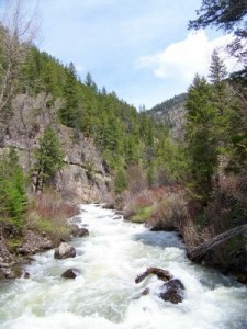
The first four miles of this adventure will take you through a canyon along Palisades Creek as you hike to the Lower Palisades Lake. This is a great hike – you follow Palisades Creek the whole way, the trail is well maintained, and you could see just about any kind of wildlife, including mountain goats. You’ll pass numerous cliffs and interesting geologic formations.

You’ll cross Palisades Creek four times before arriving at the lake, with the first bridge crossing about a third of the way between the campground and the lake and the last three coming within a mile and a half of the lake. After the last bridge, you’ll switchback up the large landslide that dammed the Lower Lake at some point. The total elevation gain between the campground and the Lower Lake is about 500 feet. With the exception of the final climb to the lake, the elevation gain is gradual. Just before the lake are a camping area and the junction with the Lake Canyon Trail.
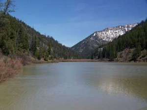
Lower Palisades Lake is fairly small. For a larger lake, continue on for about three miles to the Upper Palisades Lake. The lake is popular with fishermen and the trail is popular for just about any kind of nonmotorized activity. You could hike, run, mountain bike or ride a horse. I suspect that it’s an enjoyable cross-country skiing outing in the winter, although I’ve never tried. Various groups use this trail, including scout groups, and it is fairly close to Idaho Falls, so solitude might be in short supply.

To continue on, follow the trail over a bridge near its outlet. From here, you’ll skirt the western edge of the canyon just above the shore of Lower Palisades Lake. Past the north shore of the lake, you’ll skirt a marshy area where you might see moose or a collection of beaver dams along the trail.

About a mile and a half from the south shore of the Lower Lake, you’ll come to an area with a campground, an emergency cabin, and the junction with the Chicken Springs Canyon Trail. From here, you can continue on to the Upper Palisades Lake; you’re 1.2 miles away. A bridge due to arrive within a couple weeks will allow you to cross over Palisades Creek about a half mile up the trail and continue on to the Upper Palisades Lake.
Or, for a more unique adventure, take the Chicken Springs Canyon trail. The sign at the junction shows that you are 1.7 miles from the Thompson Creek Trail, 3.9 miles from Atkinson Peak and 6.5 miles from Rainey Creek. I didn’t make it to the top of either mountain, but I still enjoyed great panoramic views from a point about three miles from this junction. If you do what I did, plan on an adventure of about 16 miles round-trip that includes more than 2,000 vertical feet of elevation gain.
From the junction, I essentially traveled straight up Chicken Springs Canyon for about two miles before I neared the end of the canyon. This hike is interesting – it’s much less heavily traveled than the trails to the Palisades Lakes. You’ll spend some time passing through area that burned in a fairly recent forest fire. You’ll follow a creek the whole time, although water may not be flowing through it.
According to the maps of the area, there is a junction .5 miles past the Palisades Creek – Chicken Springs Canyon junction. This junction seemed to be marked with two “TRAIL” signs, one pointing you up the hill and the other pointing you up the canyon. The uphill trail was even fainter than the canyon trail, so I stayed on the canyon trail. The main trail was occasionally a little faint, but trail crews had marked the route with cuts in the bark of trees. The hike is much steeper than the first five miles of this adventure – I gained about 1,000 feet over the first two miles after the junction.
After about two miles, a trail crosses the creek and begins climbing to the top of a ridge. If you turn around, you can just barely make out the shores of Upper Palisades Lake. The trail up the ridge is steep, but as you climb, your views will improve and within a mile or so, you will enjoy a sweeping view of part of the Upper Palisades Lake, Chicken Springs Canyon, and the surrounding terrain. The views would have kept getting better, but a combination of snow and limited daylight forced me to turn around at this point.

I should note that it is also possible to access this trail system from the Forest Service road that starts at the top of Pine Creek Pass and from Rainey Creek Road. Fortunately, the Caribou-Targhee National Forest has posted some excellent hiking trail maps here at its Web site. In her excellent book “Targhee Trails,” Rebecca Woods describes an Upper Palisades Lake overlook hike that started from the Forest Service road at the top of Pine Creek Pass. She also got a better view of the lake than I did.
The verdict? This is a great area to explore, especially with the trailhead just over an hour from Jackson. It’s a particularly good hike early in the season when many of the Teton trails are still covered with snow.
Trail conditions: There was almost no snow on the trail between the Palisades Campground and the Chicken Springs Canyon Trail junction on May 31. However, there was gradually more snow as I climbed Chicken Springs Canyon and, until more snow melts, it would be difficult to get much further than I did. The National Forest office told me that the new bridge to Upper Palisades Lake was scheduled to arrive on June 11. The footings for the new bridge, which will be much sturdier than the old bridge, had already been built. Also, some wildflowers were out in the canyon between the campground and Lower Palisades Lake.
Links
